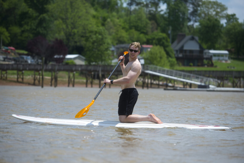
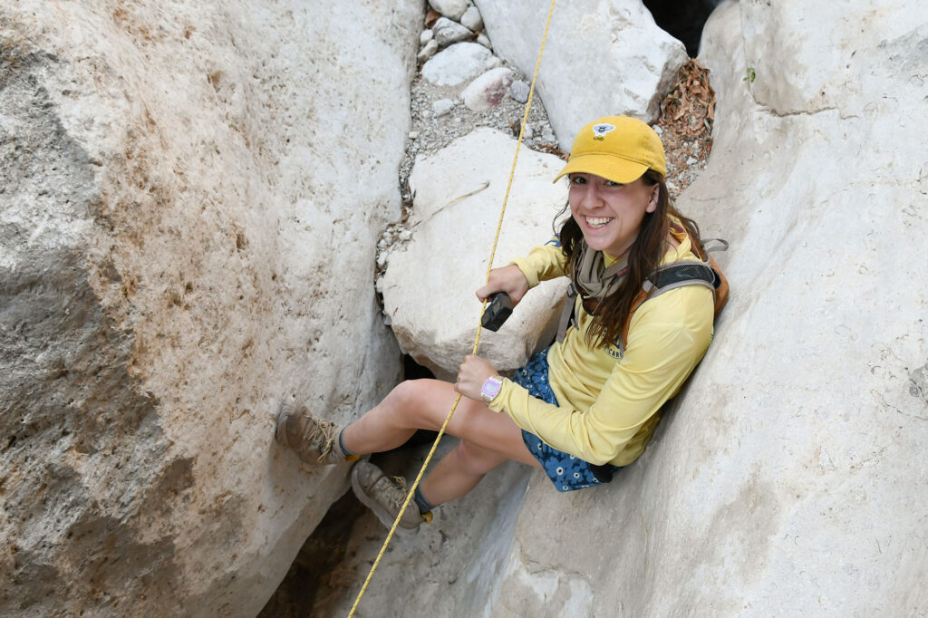
Choose Your Own Adventure
Choose Your Own Adventure

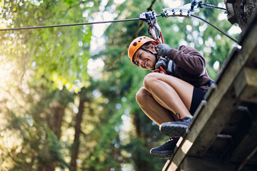
Outdoor Adventure Center


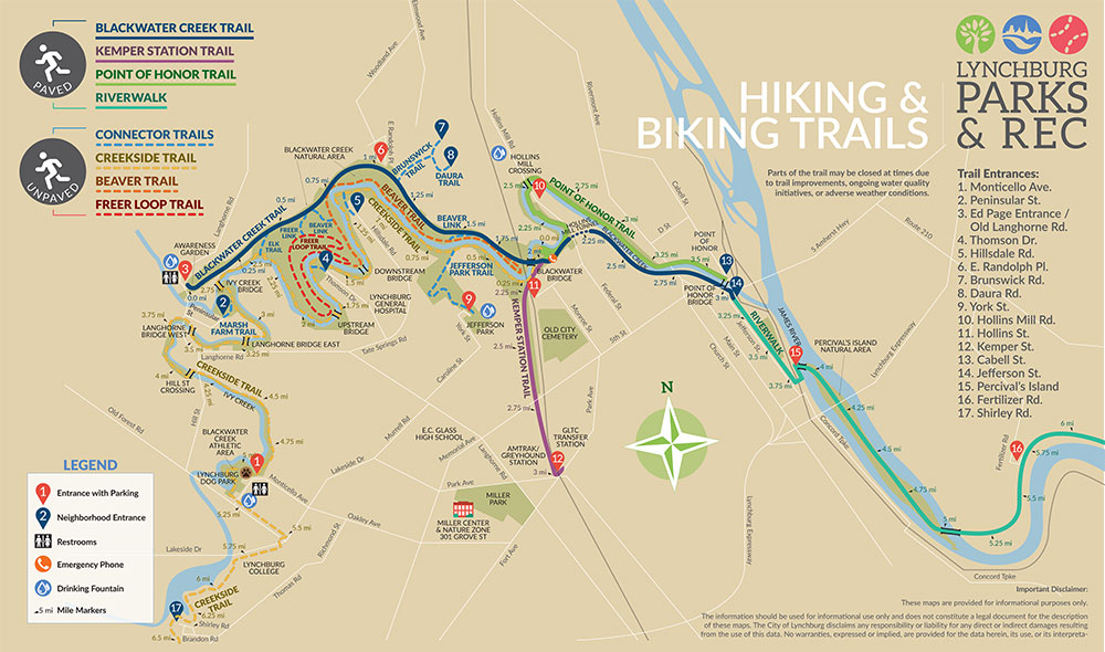
Trails of Blackwater Creek
Trails of Blackwater Creek
Lynchburg is home to a beautiful network of earthen and paved trails that run through the Blackwater Creek Natural Area. Although many residents and visitors are familiar only with the trails of Blackwater Creek, there are many trails alongside the creek and beyond to explore, including:
- Blackwater Creek Trail
- Point of Honor Trail
- Kemper Station Trail
- Creekside Trail
- Ruskin Freer Loop
- Blackwater Creek Natural Area
RiverWalk Trail
RiverWalk Trail
RiverWalk offers visitors a quick transition from urban trail to scenic nature walk. RiverWalk takes visitors through Lynchburg’s historic downtown then over the bridge to scenic Percival’s Island and eventually into Amherst County, where visitors are surrounded by the sights and sounds of the James River.
More information from Lynchburg Parks & Recreation.
Alpine Trail
Alpine Trail
The Alpine Trail was the first walking trail developed within a Lynchburg park. The trail winds through the steep hillside of Riverside Park and offers spectacular views of the James River, as well as frequent sightings of woodland birds, including migrating hawks.
More information from Lynchburg Parks & Recreation.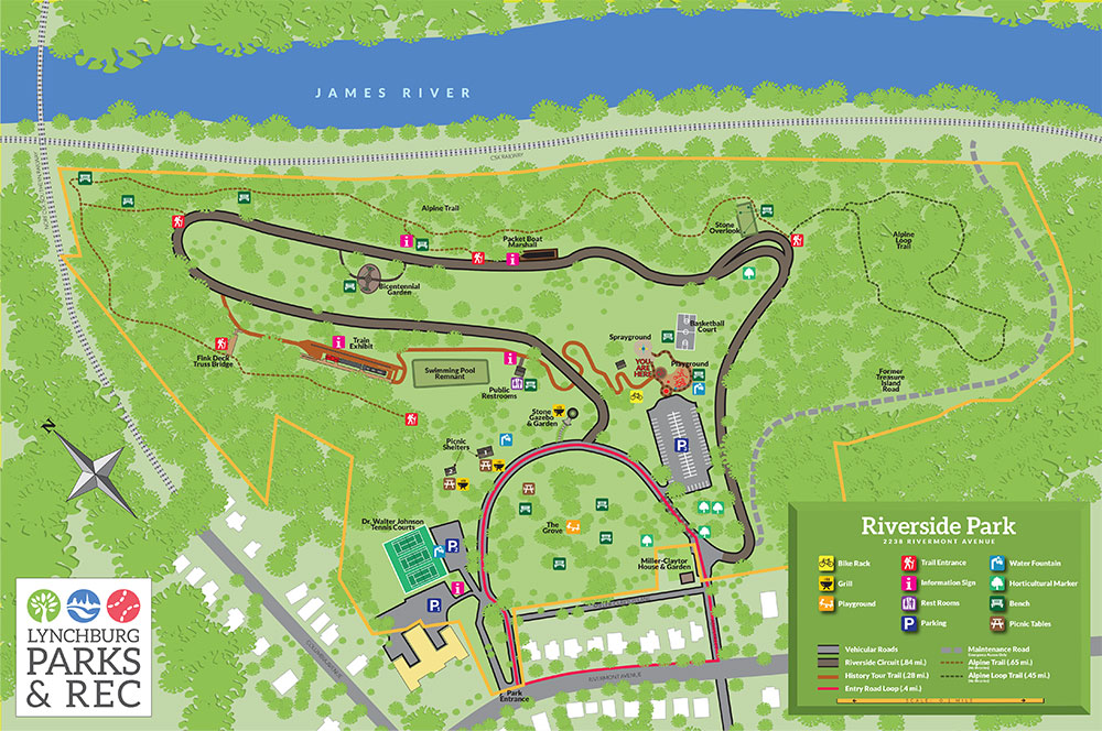
Ivy Creek Greenway
Ivy Creek Greenway
The Ivy Creek Greenway is a 1.75 mile multi-use, paved, linear trail that meanders through Peaks View Park. The trail passes through the Bill Foot Recreation Area, providing access to an extensive system of mountain bike and hiking trails.
More information from Lynchburg Parks & Recreation.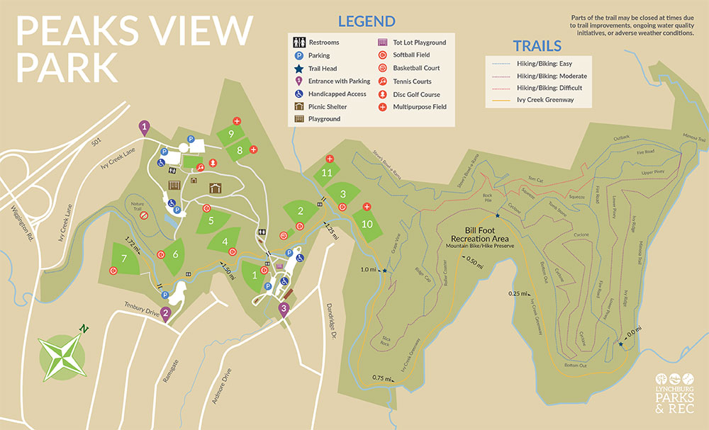
Peaks of Otter: Sharp Top and Flat Top
Peaks of Otter: Sharp Top and Flat Top
Sharp Top Trail
- Elevation gain: 1,540 feet
- Trail distance: 3.6 miles
- Hiking time: 2.5 hours plus a half hour for lunch
- Difficulty: 4
Flat Top Trail
- Elevation gain: 1,640 feet
- Trail distance: 6.2 miles
- Hiking time: 3.5 hours plus a half hour for lunch
- Difficulty: 4
More information from HikingUpward.com.

Apple Orchard Falls
Apple Orchard Falls
- Elevation gain: 1,680 feet
- Trail distance: 5.6 miles
- Hiking time: 4.5 hours plus a half hour for lunch
- Difficulty: 3
More information from HikingUpward.com.
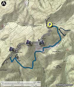
Crabtree Falls/Spy Rock
Crabtree Falls/Spy Rock
Crabtree Falls
- Elevation gain: 1,380 feet
- Trail distance: 3.8 miles
- Hiking time: 3.0 hours plus a half hour for lunch
- Difficulty: 2
Spy Rock
- Elevation gain: 3,610 feet
- Trail distance: 13.9 miles
- Hiking time: 6.0 hours plus 1 hour for lunch and breaks
- Difficulty: 4
More information from HikingUpward.com.
Cold Mountain
Cold Mountain
- Elevation gain: 1,490 feet
- Trail distance: 5.8 miles
- Hiking time: 3.5 hours plus a half hour for lunch
- Difficulty: 3
More information from HikingUpward.com.
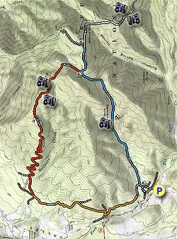
Devil’s Marbleyard
Devil’s Marbleyard
Shorter Hike
- Elevation gain: 1,510 feet
- Trail distance: 5.5 miles
- Hiking time: 5.5 hours plus a half hour for lunch
- Difficulty: 3
Longer Hike
- Elevation gain: 2,280 feet
- Trail distance: 11.3 miles
- Hiking time: 6.5 hours plus a half hour for lunch
- Difficulty: 4
More information from HikingUpward.com.
Humpback Rocks
Devil’s Marbleyard
Shorter Hike
- Elevation gain: 1,510 feet
- Trail distance: 5.5 miles
- Hiking time: 5.5 hours plus a half hour for lunch
- Difficulty: 3
Longer Hike
- Elevation gain: 2,280 feet
- Trail distance: 11.3 miles
- Hiking time: 6.5 hours plus a half hour for lunch
- Difficulty: 4
More information from HikingUpward.com.
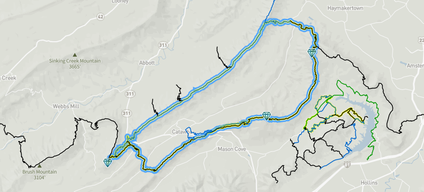
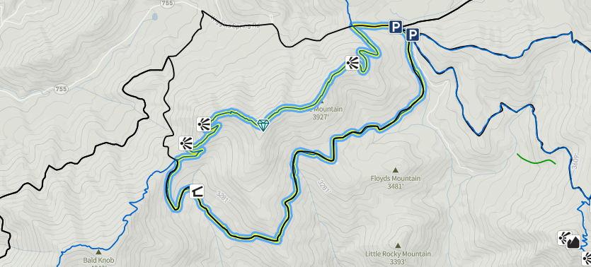
Appalachian Trail Triple Crown
Appalachian Trail Triple Crown
Dragon's Tooth, McAfee Knob, and Tinker Cliffs
- Elevation gain: 6,774 feet
- Trail distance: 34.8 miles
- Difficulty (1-5): 5
More information from HikingProject.com.
Punchbowl Mountain to James River
Punchbowl Mountain to James River
- Trail distance: 10.9 miles
- Elevation gain: 1,814 feet
- Difficulty (1-5): 5
More information from HikingProject.com.

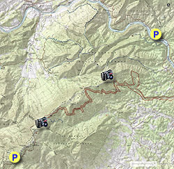
James River Face Wilderness
James River Face Wilderness
- Elevation gain: 2,900 feet
- Trail distance: 33.5 miles
- Hiking time: 9.5 hours
- Difficulty (1-5): 4
More information from HikingUpward.com.
Cold Mountain Loop
Cold Mountain Loop
- Trail distance: 6.2 miles
- Elevation gain: 1490 feet
- Difficulty (1-5): 3-4
More information from HikingProject.com.
Mount Rogers/Wilburn Ridge
Mount Rogers/Wilburn Ridge
- Trail distance: 21.5 miles
- Elevation gain:
- Day 1: 1,441 feet
- Day 2: 2,963 feet
- Day 3: 715 feet
- Optional Mount Rogers Peak: 287 feet
- Hiking time: 2.5 days
- Difficulty (1-5): 5
More information from HikingUpward.com.
- University of Lynchburg selects next president to succeed retiring Dr. Alison Morrison-Shetlar

- Curtain Call performs on March 27

- Late professor to be honored at Ota Benga memorial program
- University of Lynchburg breaks new ground with MaxImpact Degrees

- ‘Heartfelt’ gift establishes endowed award that recognizes faculty, staff